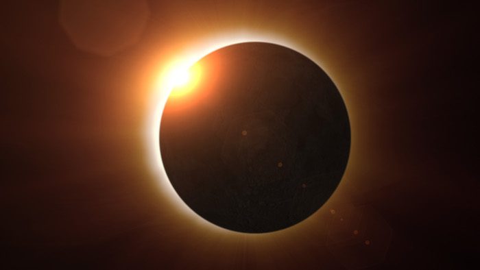
On April 8th, 2024, a total solar eclipse will sweep across North America, from Mexico to the Maine-Canadian border. For those who experienced the spectacular solar eclipse of 2017, this one will be similar, crossing the United States from west to east and passing...
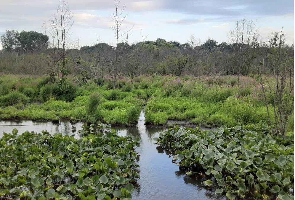
At 7:15 AM ET on Friday, September 14, 2018, Hurricane Florence made landfall along the coast of North Carolina as a Category 1 storm. Although, by this point, it had weakened from its peak intensity as a Category 4 hurricane, Florence still inundated communities in the region with torrential rains and a sizeable storm surge before dissipating over the east coast within a few days. Despite its monopoly over the airwaves in September, however, Florence was only one of four storms in the Atlantic at the time of landfall (the other three being tropical storms Helene, Isaac, and Joyce). Meanwhile, Tropical Storm Olivia (which was a Category 4 storm at peak intensity) had just dumped copious quantities of rain over Hawaii, and Typhoon Mangkhut in the west Pacific was still threatening populations in southeast Asia. In October, Hurricane Michael made landfall over the Florida panhandle with wind speeds only 2 mph shy of a Category 5 rating, making it the most powerful hurricane to hit the US since Andrew in 1992. How could so many terrible storms develop in such a short time span? Does climate change have anything to do with this? To figure that out, we first need to learn about what hurricanes are and how they form. Here’s an overview:
Depressions, Storms, Hurricanes, Typhoons, and Cyclones: What’s the Difference?
Those of you who read about these storms around the world may notice that they go by many names, including tropical depressions, tropical storms, hurricanes, typhoons, or cyclones. Most of these storms look the same on radar, so what exactly are the differences between each of them? For scientists, the umbrella term (no pun intended) for all of them is tropical cyclone. Meteorologists use the other names based on the size and location of the storm:
- A tropical depression is any low pressure system where the wind is circulating around a low pressure center, but where the wind speeds are below 39 mph.
- When a tropical depression grows and the wind speeds exceeds 39 mph, it becomes a tropical storm.
- When a tropical storm grows powerful enough to the point where winds are faster than 74 mph, it becomes a hurricane, typhoon, or cyclone, depending on where in the world it is.
- In the Atlantic and east Pacific, we call the storms hurricanes.
- In the west Pacific, they’re called typhoons
- In the Indian Ocean, they’re cyclones.
- The Category of the storm is based on maximum wind speeds.
Since the ISC is based in the US, we will mainly focus on hurricanes from this point forward.
How Hurricanes Form
The most important environmental factor behind a hurricane’s formation is the warm ocean water from which it gets its energy. During the summer months, the hot and humid air above the sea surface rises into the sky and cools, and the moisture in it condenses and forms clouds and rain. But when this air rises, it creates a vacuum below it, and new air from surrounding regions has to flow inward to take its place. This new air then heats up and draws up additional evaporated moisture from the warm ocean, continuing the cycle. Additionally, because the Earth rotates, the inward-flowing air creates a spiral that rotates counterclockwise in the northern hemisphere and clockwise in the southern hemisphere. This happens because of a phenomenon called the Coriolis effect, which we will discuss in more detail in a future post. When the ocean is warm enough and the atmospheric conditions are stable enough, these storms can grow increasingly powerful, becoming a tropical depression, storm, or hurricane.
What Does This Have to Do with Climate Change?
Because the strength of a hurricane is fueled by the warmth of the water at the ocean surface, it’s easy to see how, at the macroscale, climate change can worsen the impact of such storms. That said, hurricanes depend on a number of other atmospheric factors to form that are more difficult to forecast, including a low difference between wind speeds at sea-level and at higher altitude, which meteorologists call the vertical wind shear – when wind shear is high, large storms have trouble forming because they get distorted and torn apart as they grow. So while some research has suggested that climate change may create larger, more frequent hurricanes, it’s difficult to know for sure how much of an effect it actually has due to a certain level of randomness in how our atmosphere behaves from year to year. Nevertheless, computational climate models can still provide a lot of insight into what we can expect.
Let’s take two recent, major hurricanes as examples. Hurricane Harvey last year and Hurricane Florence this past September were both notable for how much rain they dumped over Texas and North Carolina, respectively. Scientific analysis from last year has indicated that climate change likely contributed to storms that are both slower (referring to the movement of the storm system, not wind speeds) and more wet – two qualities which can cause more intense flooding. Because more moisture evaporates over warmer waters, rising global temperatures can make storms of all kinds more rainy. Hurricane Harvey in particular was exceptionally wet (the wettest storm on record) dumping over a meter of water within three days during its peak – that much precipitation is only expected once every 9,000+ years!
Florence dumped less than a third of the volume of water over the Carolinas relative to Harvey over Texas, but it was still the second wettest storm in the past 70 years. The third wettest, while not a hurricane, also occurred within the last three years, dumping more than two feet of rainfall over a large area of Louisiana back in August of 2016.
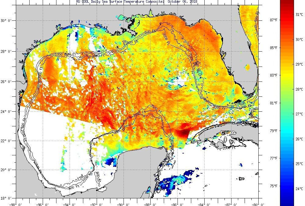
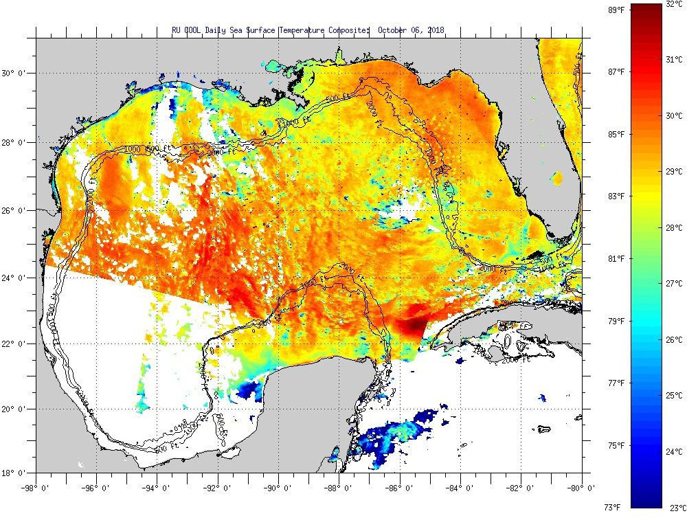 While this kind of analysis has yet to be performed for Hurricane Michael, the storm this month set records of its own that can already be seen – it was the strongest storm on record to make landfall in the US during the month of October, and the strongest on record to hit the Florida panhandle. Michael’s strength was fueled in large part by exceptionally warm waters along the Gulf Coast, which were still well above 80 degrees Fahrenheit. All of this extra heat along the storm’s path allowed it to grow from a tropical depression into a Category 4 hurricane within only a few days! Between the heavier rainfall and stronger winds, rising sea surface temperatures as a result of climate change are expected to fuel more powerful and costly storms like Florence and Michael in the decades to come.